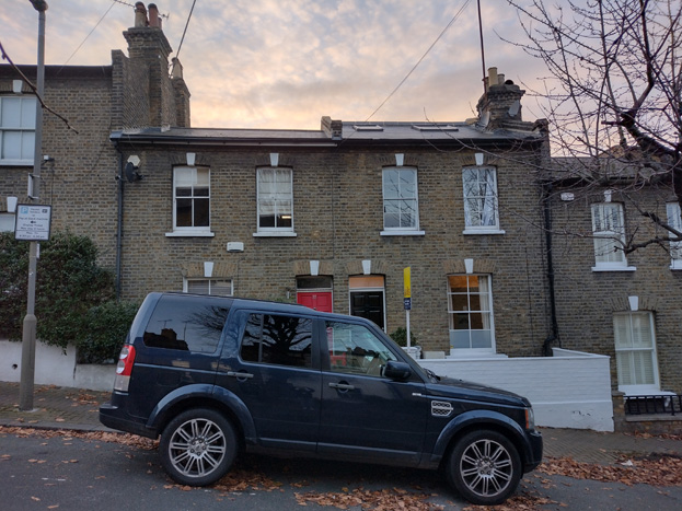
Old York Road
Conservation Area Appraisal No.47
Contents
- Part One: Introduction
- Part Two: Conservation Area Appraisal
- Part Three: Management Strategy
- Appendix 1: Locally Listed Buildings
- References
Part One: Introduction
Outline of Purpose
The principal aims of Conservation Area Appraisals are to:
- Describe the historic and architectural character and appearance of the area, which will assist applicants in making successful planning applications and decision makers in assessing planning applications;
- Raise public interest and awareness of the special character of their area;
- Identify the positive features which should be conserved, as well as negative features which indicate scope for future enhancements.
It is important to note that no Appraisal can be completely comprehensive, and the omission of a particular building, feature, or open space, should not be taken to imply that it is of no interest.
This document has been produced using the guidance set out by Historic England in the 2019 publication Understanding Place: Conservation Area Designation, Appraisal and Management, Historic England Advice Note 1 (Second Edition).
This document will be a material consideration when assessing and determining planning applications.
What is a Conservation Area?
The statutory definition of a conservation area is an ‘area of special architectural or historic interest, the character or appearance of which it is desirable to preserve or enhance’. The power to designate conservation areas is given to local authorities through the Planning (Listed Buildings and Conservations Areas) Act, 1990 (Sections 69 to 78).
Once designated, proposals within a conservation area become subject to local conservation policies set out in the Council’s Local Plan and national policies outlined in the National Planning Policy Framework (NPPF). Our overarching duty, set out in the Act, is to preserve and/or enhance the historic or architectural character or appearance of the conservation area.
Public Consultation
Public consultation on the draft Appraisal was carried out between the 10th February and 24th March 2023.
This document was approved by the Planning and Transportation Overview and Scrutiny Committee on 4th July 2023 and the Executive on 19th July 2023.
Designation and Adoption Dates
The Old York Road Conservation Area was designated in June 2019. This Appraisal was adopted on the 31st of August 2023.
Map of Conservation Area
Statement of Special Interest
The Conservation Area contains an interesting element of the wider development around Wandsworth Town during the late 19th Century, with the residential aspect providing good examples of small-scale domestic architecture. There is also interest in the legible hierarchy of housing, becoming more architecturally detailed with increased amenity space from roughly west to east. Despite some alteration, Old York Road retains architectural authenticity and offers a vibrant street scene in the context of a local shopping parade.
History and Development
Land records show that the majority of the Conservation Area was open land which was sold off in 1836 for residential development. This was shortly before the opening of Wandsworth Town Station, which opened on 27 July 1846 (as simply ‘Wandsworth’). The station predates both Vauxhall and Waterloo, as the line simply ran from Richmond to Nine Elms. It was renamed as ‘Wandsworth Town’ on 7 October 1903.
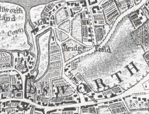
Fig. 2: John Rocque's London 10 Miles Round Map (1746)
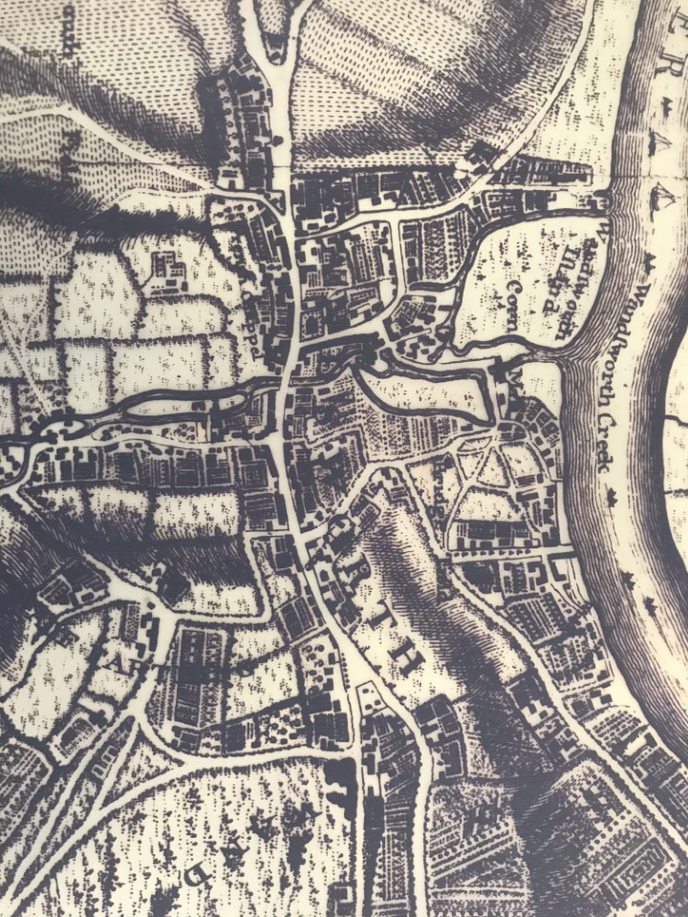
Fig. 3: John Corris’s Map (1787)
Fig. 4: James Wyld's 3" map of London, 1843-44
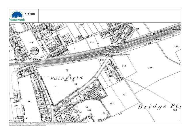
Fig. 5: OS Map 1869-1874
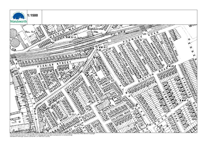
Fig. 6: OS Map 1896
Fig. 7: Bomb Damage Map (1939 - 1945)
Fig. 8: OS Map 1947-1952
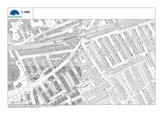
Fig. 9: OS Map 1951-1978
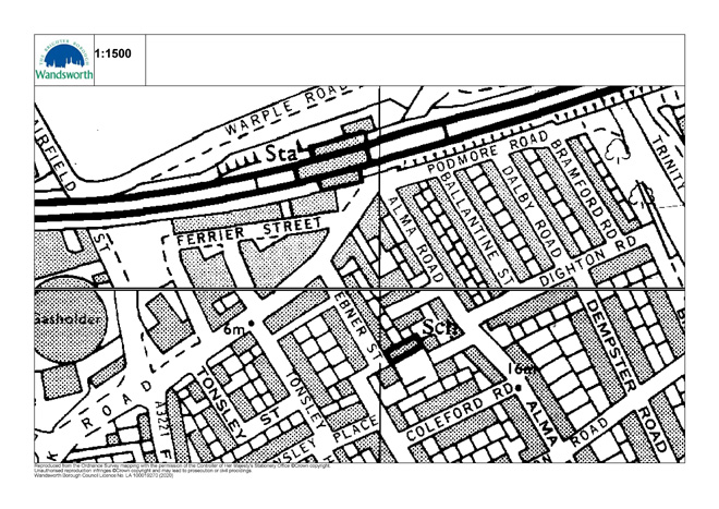
Fig. 10: OS Map 1976-1995
The OS Map 1869-74 (Fig. 5) shows that development from Wandsworth Town was expanding north, approaching the Station, but development further north-east of the Tonsleys was primarily limited to Old York Road itself, which was more open in character than the close-knit terraces and commercial buildings of the town centre. Visible on the map is a large house called ‘the White House’ at the junction of Old York Road and North Street (now Fairfield Street) set in a large garden, and open field (‘Fair Field’) to the north. The remainder of the Conservation Area was marked as ‘Bridge Field,’ save for the beginnings of denser development just to the south of the Station at Alma Road. No doubt the opening of the Station would have prompted rapid development of its surroundings, and the appearance of The Alma Pub (1872) directly opposite the Station shows there was enough traffic to merit commercial development out of the town centre, accompanied by ancillary buildings/workshops. The beginnings of terrace housing are also evident to the junction of Alma Road and Old York Road, of which Nos. 73-83 (odd) remain. These were built in the mid-19th century and are in a more Georgian style. This style of dwelling is also evident (to a slightly larger scale) to the earlier dwellings within the Tonsleys, with these houses being the earliest within the area.
From the late 1870s-1890s the entire area was developed predominantly as a residential area, consisting of small tightly-knit terraced dwellings, with Old York Road containing the commercial component. Evidence also exists of former local shops to the junctions of streets, such as the corner of Dighton and Bramford Streets.
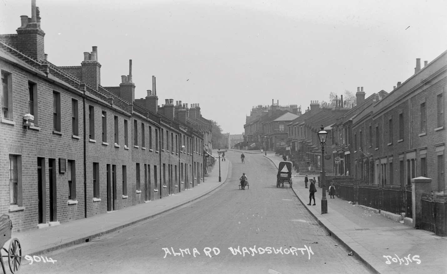
Fig. 11: Looking south along Alma Road c1920s. Source: Wandsworth Heritage Service
The Alma Public House, opposite the railway station, was the first commercial building in the area, with further commercial development subsequently constructed along Old York Road, changing the area into a small shopping parade near the Wandsworth High Street. Purpose built three storey buildings to the north side and two storey buildings to the southern side with shop fronts on the ground floor were constructed along both sides of Old York Road from the train station. By the 1890’s, the Kelly’s Directory showed several independent shop units such as bootmakers, purveyors of cat’s meat, fishmongers, grocers, and tobacconists etc (pp156-157). The rapid development of the area prompted a need for further accessibility, and rails for a tramway were laid by 1895. The tramway ceased operation in 1950, and the road returned to vehicular use.
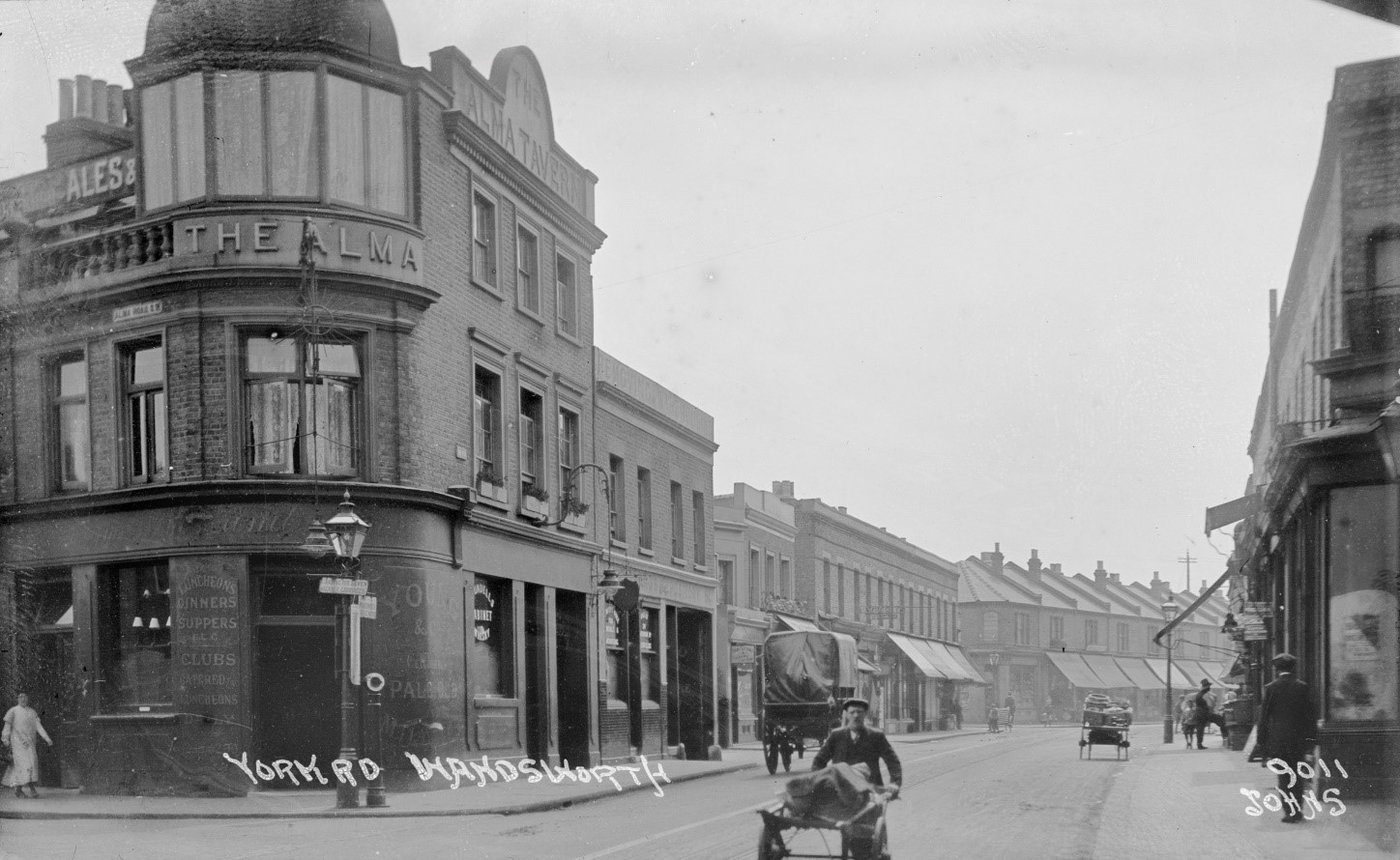
Fig. 12: Old York Road looking west from Alma PH c1920s. Source: Wandsworth Heritage Service
The area has remained relatively unchanged in its use and character, though its setting has been greatly altered with increased development and the introduction of taller buildings. One of the major interventions to the setting was the construction of dual carriageways and ring roads in and around Wandsworth during the late 20th Century. The construction of the A214 Trinity Road caused the demolition of Elmsleigh Road, Elmsleigh Terrace, and Huntsmoor Road and to the opposite side of the Conservation Area, Fairfield Street was demolished to make way for the A217 Swandon Way, enclosing the Conservation Area within these busy roads. The construction of the A217 SwandonWay also led the diversion of the main radial route and its traffic away from Old York Road. To the edges of the Conservation Area, the residential terraces along Ferrier Road, Morie Street and Edgar Road (which were also among the poorest areas identified on Charles Booth’s poverty maps) were demolished to make way for an industrial zone, which also created a courtyard area in front of the Wandsworth Town Railway Station. Only a historic wall extending from the Railway to the rear of this courtyard remains and is an important component of surviving historic fabric. The railway station received upgrade works to the front entrance in 2010, however the remainder of the railway and platforms, underpasses, and stairwells are still intact.
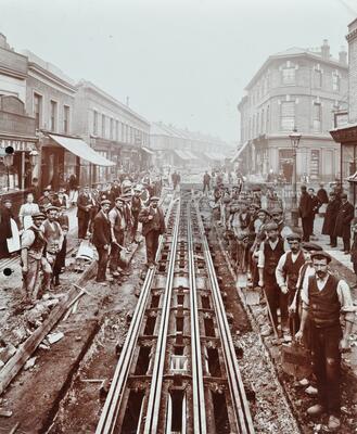
Fig. 13: Wandsworth Town Station: laying of tram tracks, 1906. The track was re-laid after removal of a 'Gas Light or Coke Company' gas main. Source: LMA. Not to be produced without permission.
Part Two: Conservation Area Appraisal
Location & Boundary
The Conservation Area is located to the south and west of Wandsworth Town Station, and is comprised of Alma Road, Ballantine Road, Dalby, Bramford, Podmore, and Old York Roads, as well as the northern side of Dighton Road.
To the north the area is bounded by the tracks from Wandsworth Town Station, the west by Tonsley Hill, to the east by Trinity Road / A214, and to the south, Dighton Road separates the Conservation Area from the Wandsworth Town Conservation Area.
Setting & Topography
The area has quite a gradient topography, the land rising away from the Station from north to south, with the highest topographical points of the area experienced along Dighton Road, which forms the southern boundary of the residential character area. From Dighton Road, views across the rooftops of the tightly knit Victorian terraced streets are experienced with the dwellings stepping down the hill which terminates at Podmore Road. Houses are terraced and two storeys with slight variation in design and boundary.
The residential section of the Conservation Area forms part of a wider area of Victorian speculative development, which served the industrious Wandsworth Town to the south and west, while it is separated from other development to the north and east by the raised railway line and the A214 respectively. which creates a sense of enclosure to much of the Conservation Area.
To the west of Wandsworth Town Station the area is relatively flat and is comprised of the small station forecourt and the short commercial parade of Old York Road. Development is predominantly 2 and 3 storeys with most buildings containing traditional styled timber shopfronts, with some historic shopfronts still in situ. A continuous frontage and consistent building heights creates a sense of enclosure, meaning that the setting and views are somewhat limited to the east and west ends, where longer views out of the Conservation Area towards new, taller development is evident. Adjacent to the Station, along Ferrier Street, tall buildings impose on the smaller scale character of the Conservation Area, with views leading toward the former gasworks site. The emerging context of the setting is taller building development, particular along the A217 which impacts views to the east toward the rail bridge, as well as projecting above the elevated railway line from the higher points within the residential area.
Development of former industrial and commercial sites will see further tall building development introduced to the setting of the Conservation Area and impact its setting. Tall buildings emerging to the north and east of Wandsworth Station will greatly impact the setting of the Conservation Area, and heighten the importance of its small scale, domestic character, and appearance as a historic focal point. These taller buildings will be readily visible in views from within the Conservation Area, with the station providing a clear boundary between the Conservation Area and contemporary development.
Character Areas
The Conservation Area can be divided into discernible character areas which are predominantly defined by their use: residential and commercial
- Area 1: Residential Area comprising Alma Road, Ballantine Street, Bramford Road, Dalby Road, Dighton Road, and Podmore Road;
- Area 2: Predominantly commercial/mixed use area comprising Old York Road and Wandsworth Town Train Station
Character Area 1: Residential
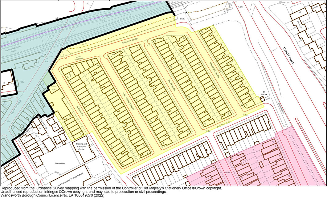
Fig. 15: Residential Character Area Map
Townscape Overview
The streets within the residential character area are laid out in a simple grid arrangement, a surviving fragment of a wider area of Victorian speculative development that extended east and is primarily comprised of four short parallel streets. The area is entirely two storeys in scale excluding the Alma Pub, comprised almost exclusively of simple brick residential terraces. While there is a legible basic typology to the different streets, as detailed further below, there is a commonality of features which creates an impression of homogeny. These include:
- Domestic scale
- Stock brick construction
- Slate or tile roofs
- Low party walls
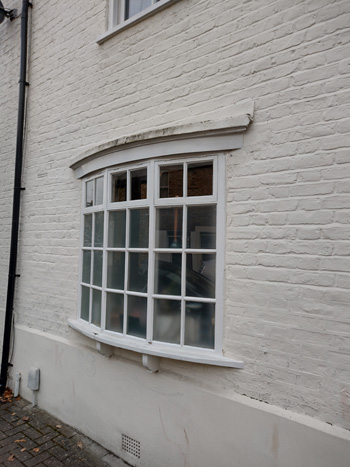
- Simple timber sash windows of a single pane or in a two-over-two formation
- Two bays in width, often two windows to first storey, and one window with entrance to ground
- Mirrored pairs
As the terraces extend the length of each street, there is a continuous frontage which creates a sense of enclosure and the impression of a residential enclave. The framing of the area to the north and east by the raised railway and Trinity Road heightens this impression and limits the accessibility of the area by vehicle to the south, which heightens a sense of enclosure/privacy and a pedestrian scale.
Views
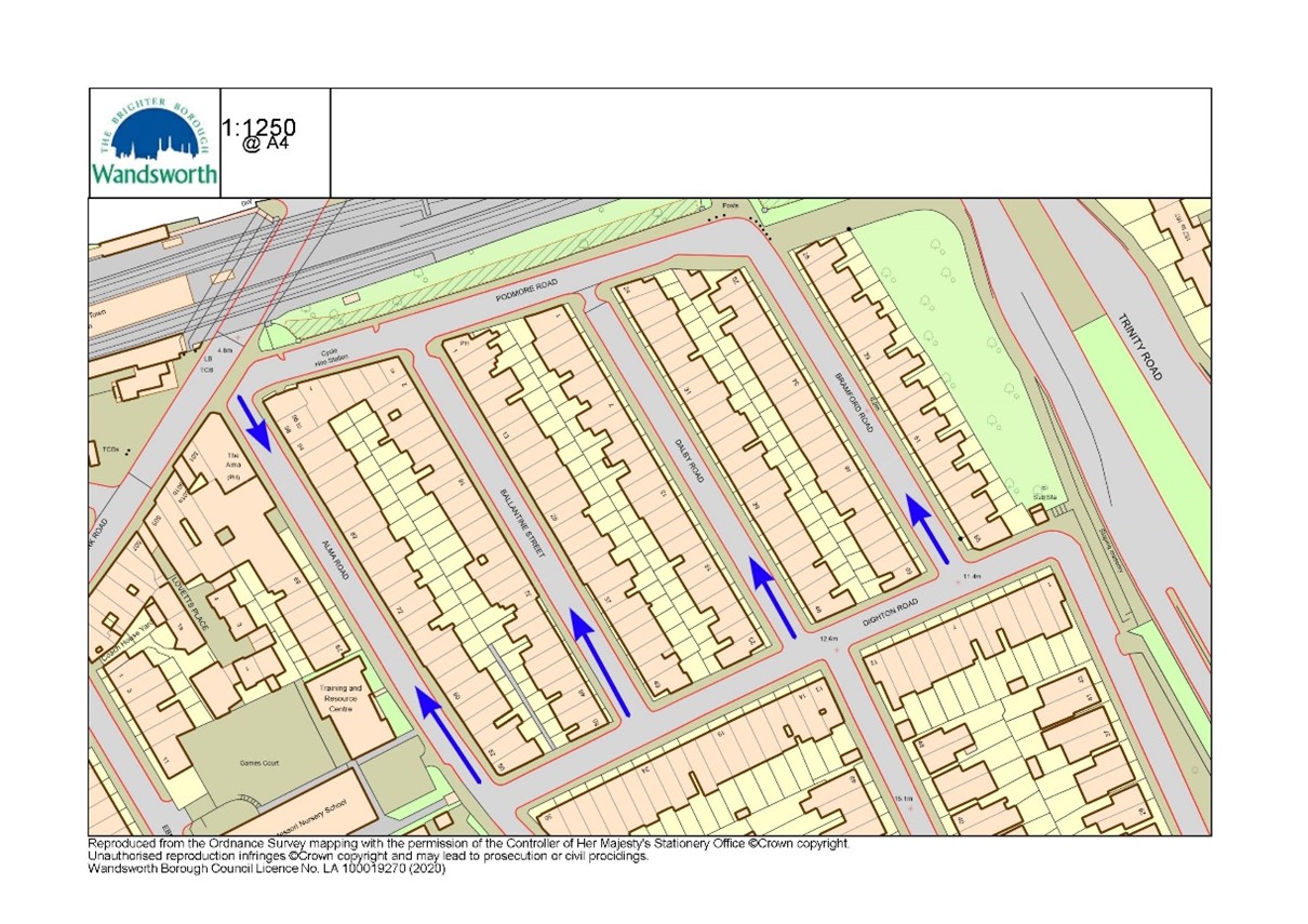
Fig. 16: Views within Residential Character Area
The main views within the Residential character area from Dighton Road, looking north toward the Railway Line and beyond (Figs. 17-20) – each of these views offers a glimpse of the terraces to each side, and the distinct stepping of paired houses with the slope of the topography most evident and attractive from this elevated position. The gradual stepped roof forms are a key part of the appearance of the area, when viewed from these vantage points. Longer views beyond the railway currently terminate with mid-rise development, but with the emergence of taller buildings around the Station, this will evolve to contrast with the local context. Future tall building development should consider the impact on these views and the setting of the small-scale domestic architecture of the Conservation Area.
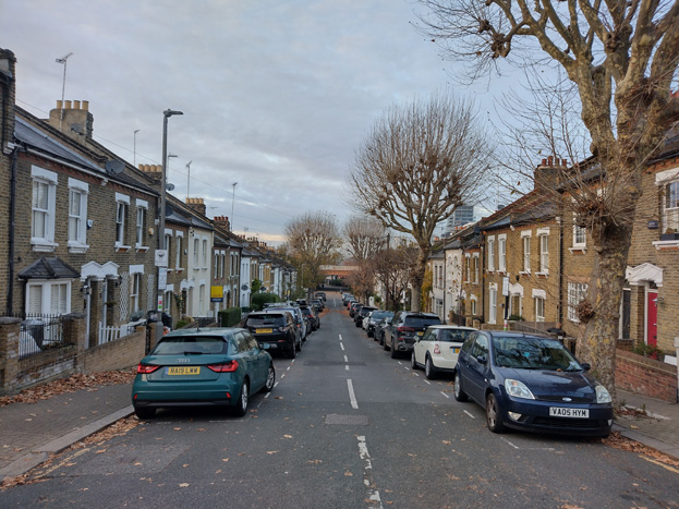
Fig. 17: The view from Bramford Road terminates with the railway bridge – taller building development is visible projecting above the terrace to the east. Redevelopment of the site immediately north of the bridge will introduce further tall buildings into this view
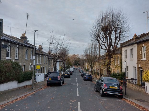
Fig. 18: The view from Dalby currently terminates with the boundary wall to the railway line and scrub – proposed redevelopment north of the railway will project upwards into this view
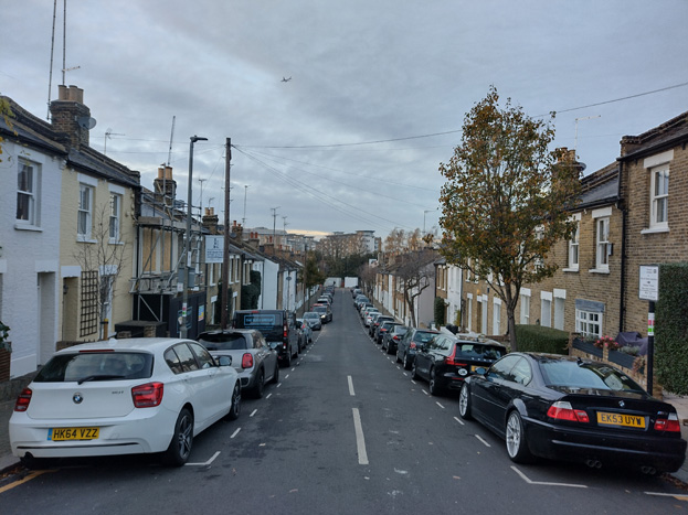
Fig. 19: Mid-rise development currently frames the end of Ballantine Road
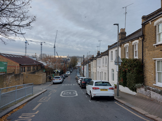
Fig. 20: Mid-rise development is also visible in longer views down Alma Road, with taller building development proposed along Ferrier Street to the north of the railway
Area Description
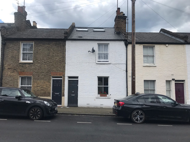
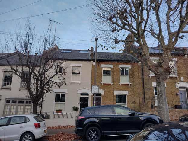
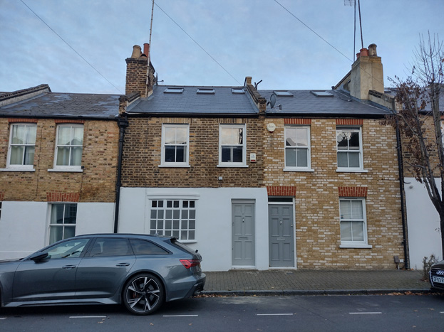
Most buildings within the residential character area date from the Victorian period, though there is a small late-Georgian development to the west side of Alma Road constructed in the mid-19th century. The slightly later Victorian houses are typically more ‘workers cottages’ style of two storeys between one and two bays wide and were constructed between the late 1870s -1890s. The houses are primarily constructed with pitched roofs and largely London brick with some use of Gault brick. Some dwellings have small front gardens whereas others have no setback from the footpath.
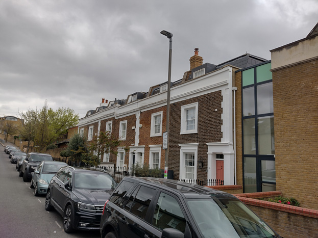
Fig. 21: Short Georgian Terrace at Alma Road
In addition to responding to the topography of the area, this layout appears to be indicative of a shift in social class, with more modest workers cottages, which lacked front gardens, closer to the Station and slightly higher status homes with more decorative façades and front gardens further away to the south-east.
This shift appears to be evident on the Charles Booth’s poverty maps (Inquiry into Life and Labour in London (1886-1903)). This map (Fig. 22) categorises Alma and Ballantine Road as containing a mix of comfortable and poor residents, while to the east, residents were described as ‘fairly comfortable, good ordinary earnings,’ sitting below the middle class.
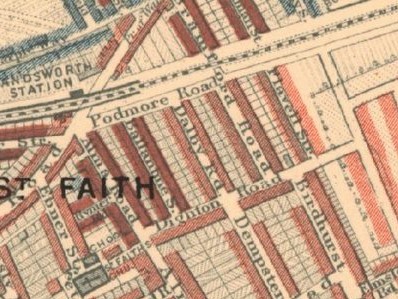
Fig. 22: Booth’s Poverty Maps 1886-1903. The denser red marks to the left indicate the lower status streets. Source: LSE
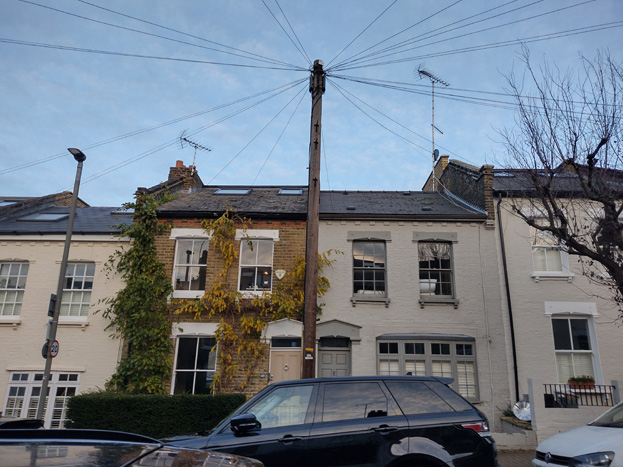
Development in the area has often sought to enlarge the smaller homes, regularly including the erection of rear mansard roofs and outrigger extensions. These extensions require taller party walls and, in some instances, has resulted in the raising of ridge heights, which has led to inauthentic roof forms and an inconsistency in the roofline, which is particularly evident in views from higher elevations when the roofscape slopes down toward Podmore Road. This visually disrupts the unity of the terraces and is a negative aspect of the area.
The layout of the streets and topography of the Conservation Area means that many of the rear elevations of terraces can be clearly seen from the public realm, and the remaining consistency and regularity in their form makes a positive contribution to the character and appearance of the area.
Despite some alteration, an overall sense of homogeny persists, where houses largely have the same form but with slight variations – this is particularly evident in the simple architectural embellishments which differentiate the original builder and reflect the minor change in status as one shifts through the area.
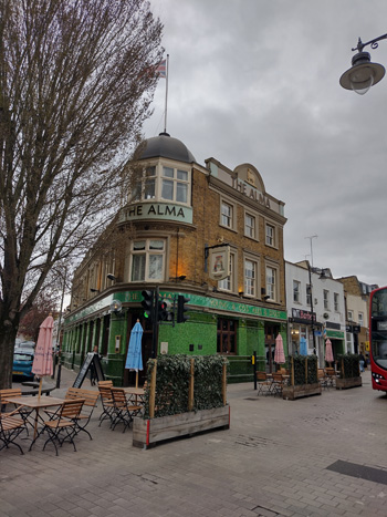
Alma Road
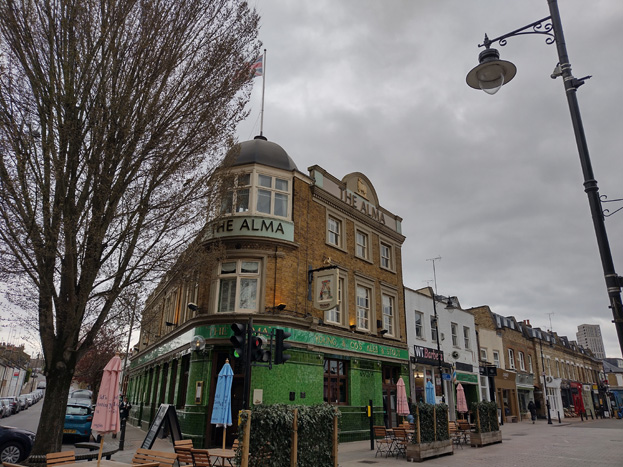
Fig. 23: The Alma Public House forms a landmark within the CA and is a transition point between the two character areas
Alma Road is the most westerly road in the residential area and historically housed the poorest of residents, which is reflected in the modest design and form of the worker’s style cottages and contains some of the earliest development in the area.
At the north-west corner of the character area is The Alma Public House (locally listed), which serves as both a landmark building and a transition point to the two areas, visually and through its use. The Victorian pub sits on a corner site, and at three storeys, sits prominently above the surrounding two storey development. This larger scale contributes to a sense of arrival to the start of the shopping parage from the Station, as well as highlighting the importance of the pub, and by extent, the brewing industry, to the wider area. The modern extension steps down to the south in response to the adjacent housing within the residential area.
Immediately to its south is a short Georgian terrace of six houses dating from the early to mid-19th Century, and are two storeys with a parapet, which originally would have had a London Roof behind, but have since been replaced with mansard roof extensions. The dwellings are a single bay with London brick and stone plinth, quoins, cornice, and window surrounds, and have entablatures around the front doorways which are grouped in twos. Although the roofs have been modified, they remain relatively consistent in their appearance as tiled mansards with a single central dormer. The group is of architectural and historic interest as the earliest residential development surviving in the Conservation Area, pre-dating and contrasting in style and status with the simpler Victorian terraces which otherwise dominate.
The houses to the east side of Alma Road are the most simply designed in the area, lacking any decorative embellishments or details. These were the most basic style of worker’s cottage accommodation, which is similar to other examples of similar typologies surviving throughout Wandsworth and linked to its industrious heritage. Nos. 66-94 follow the same design, the unpretentious and functional design reflective of the original purpose and occupant. No 52-64 differ in appearance and were likely constructed by different builders and are more like the houses on the adjacent streets, as they have a slightly elevated design including a simple cornice, bracketed sills, and decorative lintels, and Nos. 52-56 also have narrow front gardens. Nos. 56-60 have inauthentic painted and rendered façades, as well as the introduction of ashlar plaster to the ground floor level, which harms the appearance and consistency of the original modest architectural detailing.
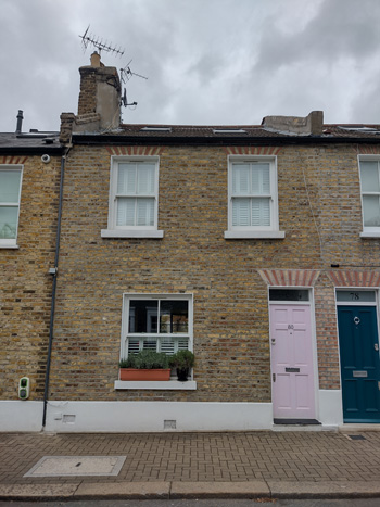
Fig. 24: Standard typology to Alma Road
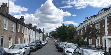
Fig. 25: View South along Alma Road showing the contrast between earlier Georgian group and much simpler Victorian terrace
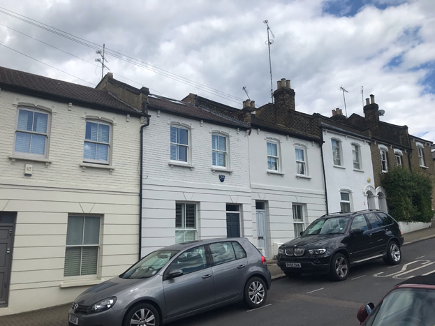
Fig. 26: An altered section of Alma Road – the addition of render, paint, and quoins, harms the original modesty of the architectural composition
Ballantine Road
Nos. 2-32 (even) & 3-33 (odd) are of an almost identical construction to the simpler terraces on Alma Road though some only have a single window to the second floor and there is a higher degree of intervention, including bow windows and rendering to ground floor elevations. Again, these houses open directly onto the street, suggesting a lower grade of dwelling and features are simple, with plain sills, simple flat arches, and narrow transom windows above doorways.
To the south side of the road, Nos. 34-50 (even) & 35-49 (odd), small front gardens begin and thus boundary treatments become a feature. These are typically low brick walls with short rails although there is little consistency to their treatment. The slight setback of the houses allows for a front pathway and there are some surviving original red and black tessellated tiles in a diagonal pattern, which is characteristic of the area, as well as some modern replications. These houses all have two windows to second floor, and simple decorative embellishments are apparent, which give a sense that these houses are of a marginally higher status than those to the north or along Alma Road. These elements include more robust masonry lintels and a simple three bracket cornice.
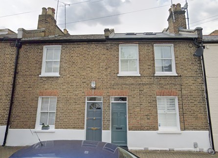
Fig. 27: The more simply detailed typology to the north side of Ballantine Road
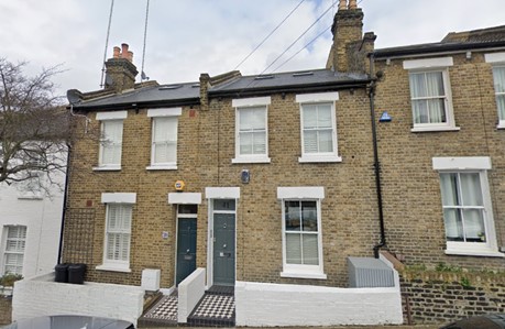
Fig. 28: More detailed typology to the south side of Ballantine Road with front gardens
Dalby Road
The houses to Dalby Road are more consistent in their design, being of a single plan repeated in pairs, and again have a slightly elevated appearance from development to the west of the character area. The houses here have more decorative segmental arches with ornamental keystones and a cogged brick cornice. Front gardens are deeper and boundary treatments are again now inconsistent, with low brick walls with rails predominant.
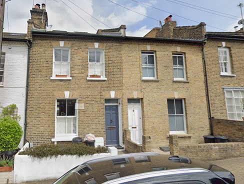
Fig. 29: Dalby Road typology with keystones and cogged cornice
Bramford Road
The houses along Bramford Road have the greatest degree of architectural embellishment, reflective of the ‘fairly comfortable’ occupants these were constructed for. Houses remain in pairs and typically have flat decorative pediments to entrances. Sills are bracketed and windows are topped in painted masonry lintels with modest engravings.
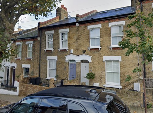
Fig. 30: Bramford Road typology
Podmore Road
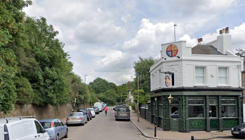
Fig. 31: View east along Podmore Road
Podmore Road primarily serves as an access road to the residential streets, and its character is comprised of the flank elevations of the terrace ends and brick boundary walls to the south, and the concrete wall with rail above following the railway line to the north. Here, terrace ends have hipped roofs which bookend the groups along with matching roof forms at Dighton Road. These hipped roofs form an important feature of the terrace groups as a whole and are largely unaltered.
At Ballantine road, No. 1 is the locally listed The Royal Standard Public House, which has a prominent corner entrance. The pub forms an enticing visual contrast to otherwise modest terraces, and its corner position invites the eye and pedestrians into the area. Its small scale and humble design make it feel very much like a ‘local’ and it is of historic significance as a reflection of the importance of the brewing industry to the area.
Across from the pub is No. 5 Podmore Road, a corner dwelling which would have originally responded to the terraces but has since been modified to a degree that it detracts from the character and appearance of the area, including render and paint, glass block and casement windows, and window bars. Nos 1-4 are mid-70s live/workspaces, but some have now been converted to include self-contained flats. The group responds poorly to the character of the area, and contrasts with the grander Blenheim House at the corner of Podmore and Alma Roads.
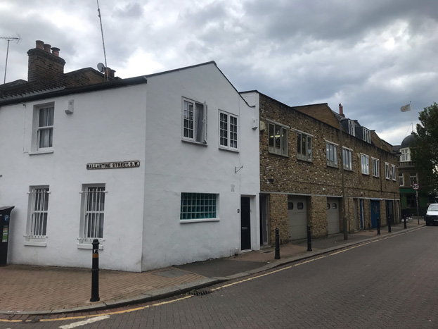
Fig. 32: Nos. 1-4 the 70’s live-work spaces & No. 5 are negative buildings
Dighton Road
Dighton Road is somewhat unusual in that it is primarily characterised by the secondary / side elevations and boundary walls of the houses at the end of the terraced groups. Although the main entrances to the end houses are to Dighton, typically marked with a pediment or pilasters, these are purposefully simple elevations with little intervention, and where windows have been inserted, this has drawn attention away from the principal elevation. Instead, architectural detailing is preserved for the primary elevations, on the respective perpendicular streets, which match the general design of the terrace it forms part of. This is to create the illusion of consistency to the terraces along the main roads and is an important feature of the character of the area. As with Podmore Road, the ends of the terraces have unaltered hipped roof forms which create an attractive roofscape and complete the group.
Nos. 50 & 65 have three elevations, with 65 having a projecting corner element, indicating it was originally a local shop. The ground floor has masonry banding and a single surviving corbel, which likely formed part of the former shopfront.
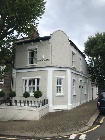
Fig. 33: No. 56 was formerly a shop and while it addresses Bramford Road, the main entrance is to Dighton Road
Boundaries
Throughout the character area there are some limited examples of historic rail features surviving, such as anchors for gate posts within paving stones, though much was removed likely to assist the Second World War effort. There is limited evidence of the original boundary type, many having been altered or replaced, and extant boundaries are extremely inconsistent. Despite this inconsistency, their presence adds character to the street and helps with the legibility of shifting status as one travels through the area, and many are sympathetically designed. The most common type of boundaries are low brick walls with short columns, some with rails above, and historic photos from the surrounding development (such as Dighton Road, although much more decorative) show this was a common approach for this housing type and location, which probably carried through the character area. Gates are generally simple cast iron swinging gates.
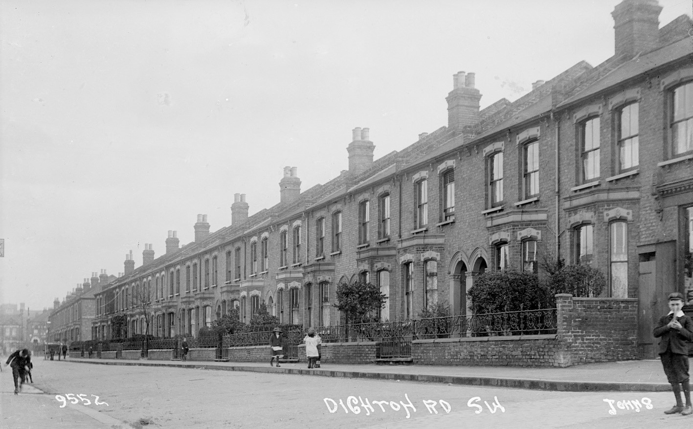
Fig. 34: Example of historic boundary treatments to nearby street
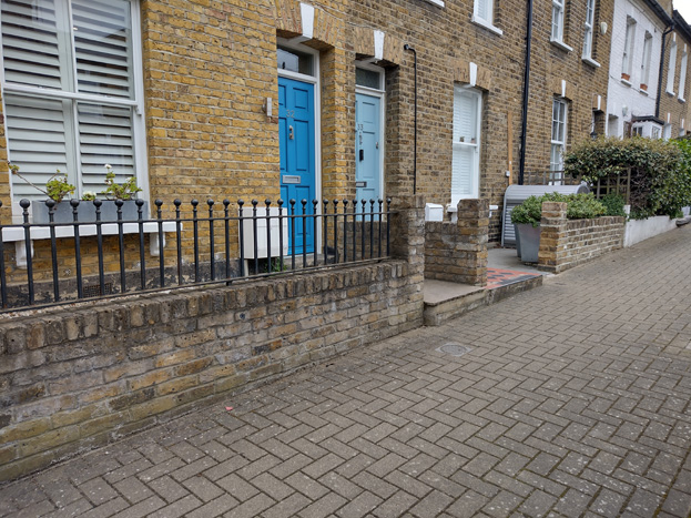
Fig. 35: Example of common boundary treatments
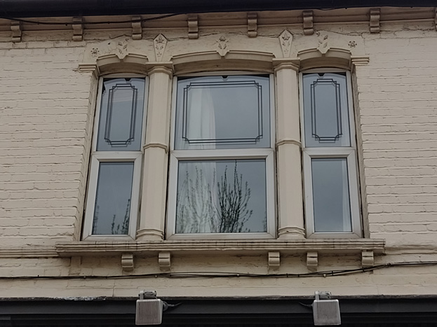
Windows
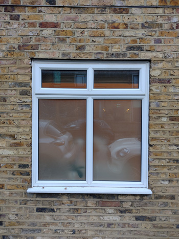
Windows would have originally been typical white painted Victorian single or two-over-two sashes with horns, excluding the Georgian style group to Alma Road, which would have more traditional six-over-six sashes.
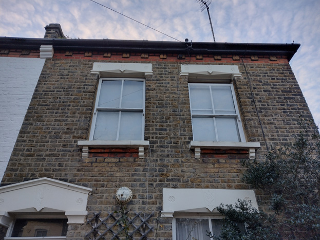
Fig. 36: Typical Victorian window style with single glazing bar
Entrances & Gardens
Like windows, doors have been extensively replaced and tiled front pathways removed or altered. Original doors are four-panel doors with plain fanlights.
Front paths would have regularly been finished in red and black tessellated tiles in a diagonal pattern, and many good examples or replacements are evident. Contemporary approaches such as matching patterns in neutral colours maintains the character, but plain concrete or monochromatic tiling/paving stones are discouraged.
To some front gardens, lightwells have been introduced, which are typically well concealed and occupy an appropriate portion of the garden area. However, this is often combined with the remainder of the garden covered in solid materials, which detracts from the suburban character and appearance of the area.
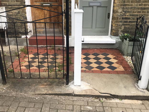
Fig. 37: Examples of historic tiling surviving, although many are in poor condition
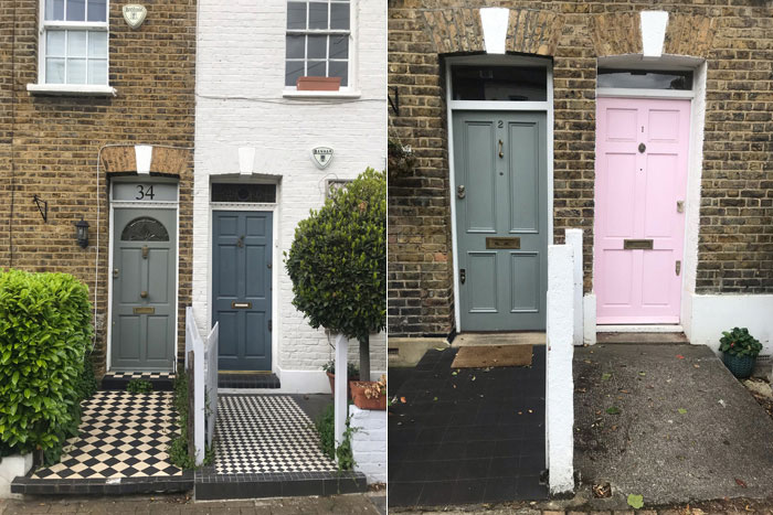
Figs. 38 & 39: Detail of entrance treatments, with modern tile footpaths (left) and original 4 panel doors and pastiche 6 panels which reduces the height of the fanlight (right)
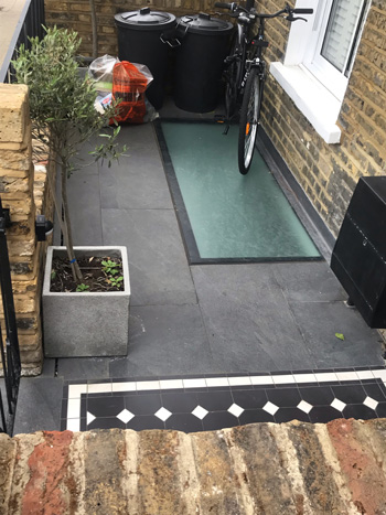
Fig. 40: Full hard standing to front gardens should be avoided
Basements and Lightwells
Lightwells are uncommon and would have been approved prior to designation as a Conservation Area. Where there is a lightwell and the remainder of the garden covered in solid materials, this detracts from the suburban character and appearance of the area.
Basements are also uncommon but have emerged as an option to extend houses without overtly visible interventions and to make use of existing excavated cellar spaces. Evidence of basement additions, such as lightwells and lower ground floors, are not characteristic of the Area.
Roofs and Roof Extensions
As long terraces, the predominant roof style is gabled with hipped ends, separated by low party walls. The most common roofing materials are slate or tile, and while a few historic examples remain, many roofs have been updated when extensions or other works were carried out. These interventions often used artificial slate or concrete tiling, which are unsympathetic pastiche materials.
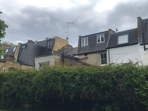
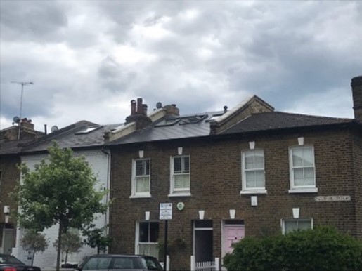
Roof extensions have become increasingly common in the Conservation Area, and both mansard and outrigger styles are evident. Many have resulted in taller roof ridges which have broken the visual consistency of their host terrace, disrupting the characteristic ‘stepping’ of the roofscape, and eroding the character and appearance of the residential street scene.
Extensions are typically finished in matching materials, but this is often updated to modern materials. While there is some consistency in the appearance of the extensions, they often introduce new ridge heights, extend the full depth of outrigger extensions, or square off rear elements rather than having angled walls which would retain legibility of original planforms. These large and deep extensions are predominant in views to rear elevations.
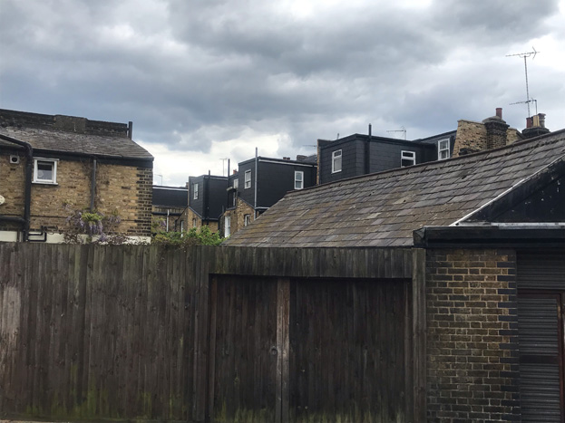
Figs. 41 & 42: Various roof extensions are increasingly common and impact views through the rear of properties
Figs. 43 & 44: Examples of a raised roof ridges in a modern finish which projects the centre terrace above its neighbour despite being lower on sloping road – they should match their partner to the left
Figs. 45-47: Further examples of imbalanced pairs
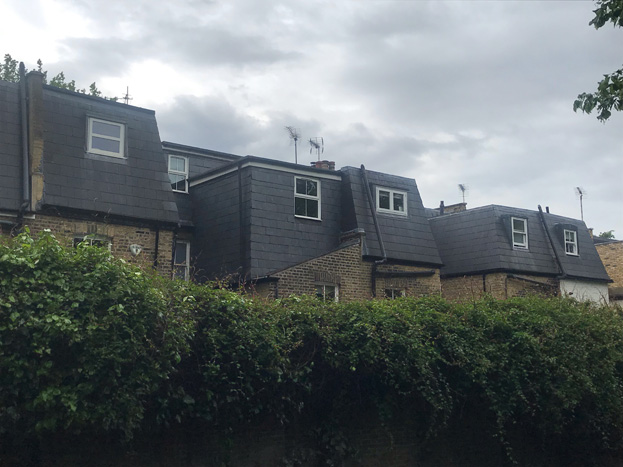
Fig. 48: Outrigger extensions are largely consistent, but some are of a different form, finish, position, and scale, which creates an imbalance to rear elevations
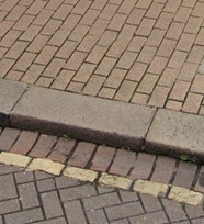
Paving
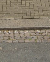
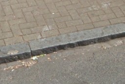
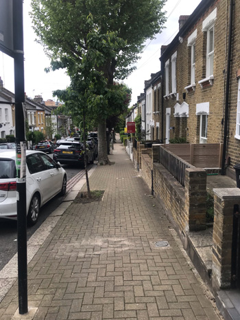
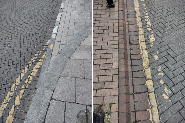
Paving within the area is relatively consistent with all pavements finished in brick, primarily in a herringbone pattern, but with some running bond where brickwork has been replaced, such as to the ends of Bramford/Podmore Roads, and the south side of Podmore. Kerbs are original granite.
Podmore Road is fully paved in herringbone purple brick, and this extends into the entrance to each road at either end. Adjacent to the kerb at Bramford and Dalby Roads are narrow strips of cube setts which are indicative of earlier paving materials. Another small patch of setts is evident to the east of The Alma, which transitions to paving slabs toward the station approach.
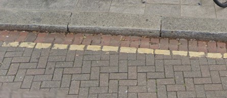
Figs. 49-52: Various paving types, using brick, stone, and asphalt
Trees
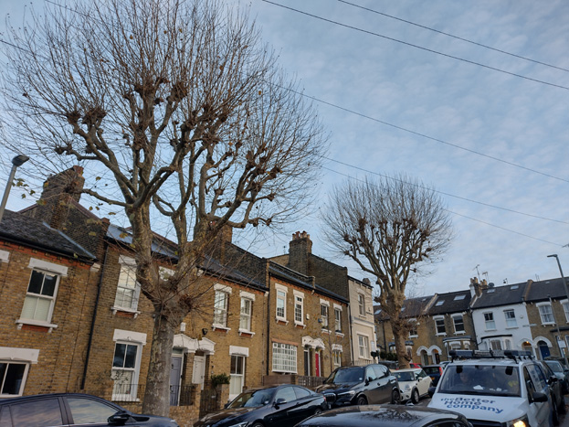
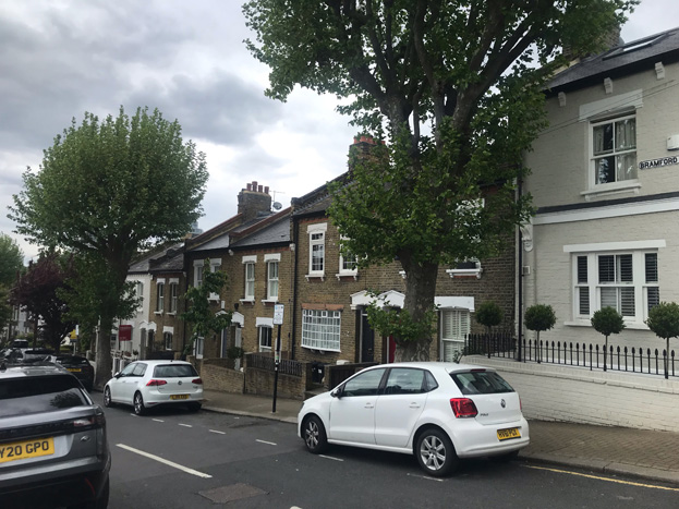
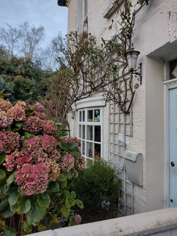
There is variation in the presence of trees, which is reflective of the status of the houses as described previously and fitting with the raising of this status as one moves away from the Station. Alma Road is almost devoid of trees, whereas Bramford Road with several London Plane trees has the largest and most mature trees. Some of these have been felled and replaced with smaller ornamental trees which has created an imbalance in the leafy ‘boulevard’ character of the street, and such replacements should be avoided in future. Both Ballantine and Dalby Road have a good balance of smaller species flanking the roads, supplemented by shrubs and bushes in the small front gardens to the latter. While existing planting could be improved to highlight the transition of housing typologies, the presence of trees and the contribution they make to a small-scale residential feel, makes a stronger contribution to the character of the area as a whole and improves the appearance and quality of the space more generally.
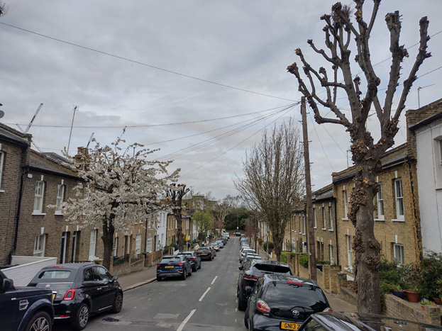
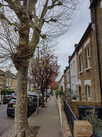
Figs. 53-57: Trees in different seasons – more traditional London Plane have been replaced with smaller ornamental varieties
Street Furniture
Street furniture within the character area is limited and primarily comprised of lampposts which are modern and unremarkable, and telegraph poles in the typical timber. Parking signs are regularly spaced, as are parking meters, equally unremarkable and strictly functional in their appearance.
There are several bollards to the west side of Podmore Road, which continue from Old York Road and act somewhat as a guide for pedestrians through the area toward the crossing at Trinity Road.
Cycle Parking
Cycle Parking in the character area is limited with a small number of Sheffield stands on the paved island between the junction of Alma, Podmore, and Old York Road. The west side of Podmore Road has a large TfL cycle hire stand, which primarily serves the Station.
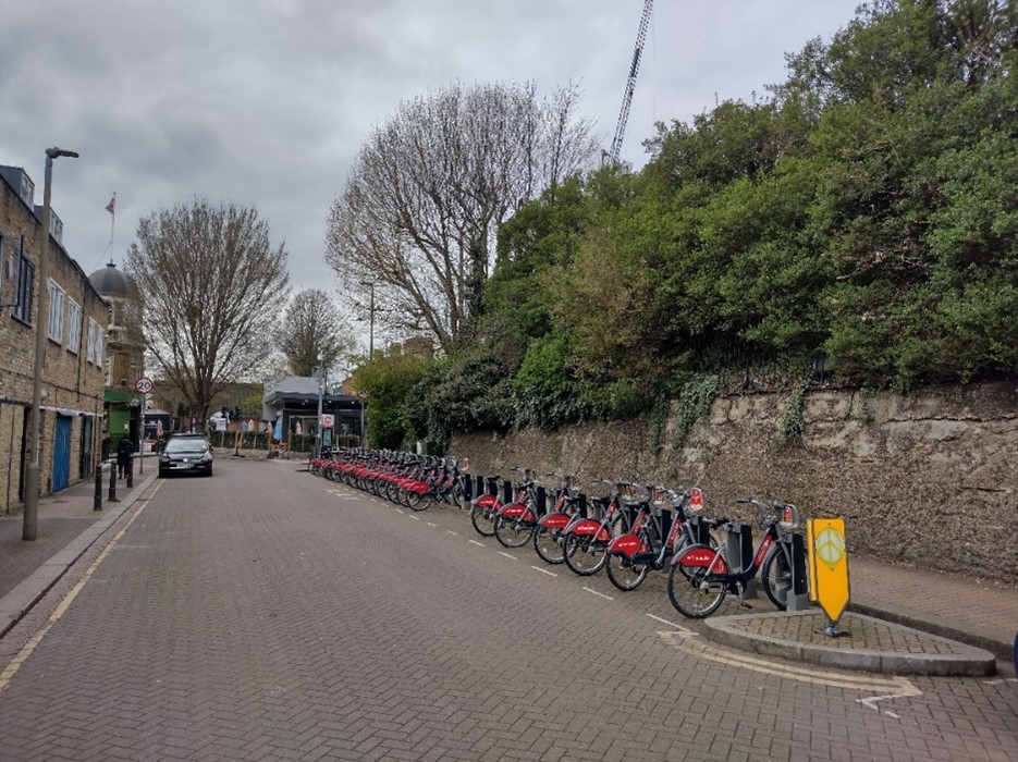
Fig. 58: Cycle hire stand
Detracting Features
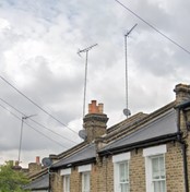
- Antenna and satellite dishes
- Irregular window forms (oriole, casement etc.)
- uPVC windows
- Unsympathetic extensions
- Bulky mansard and outrigger extensions
- The resultant raising of roof ridges
- Render and painting of principal façades
- Including the addition of unoriginal detailing (quoins etc.)
- Introduction of unoriginal roof materials
- Tile
- Artificial roof slates

Character Area 2: Commercial (Old York Road)
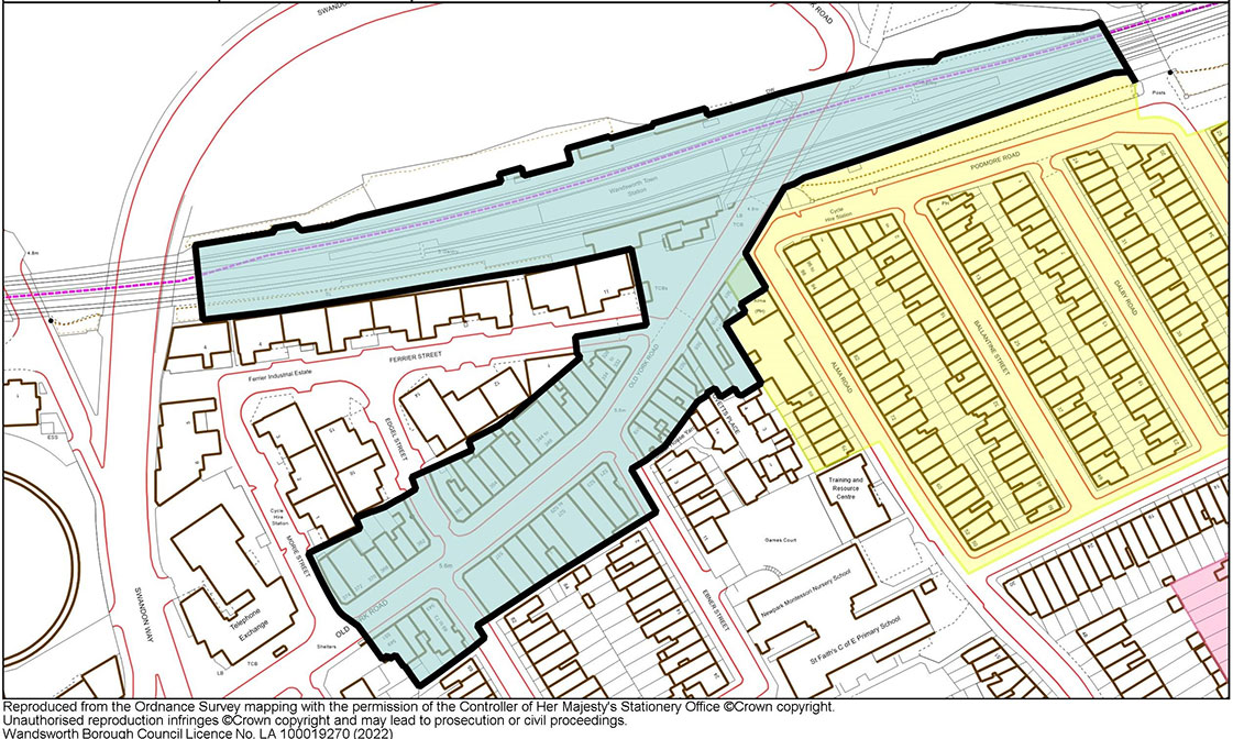
Fig. 59: Commercial Character Area Map
Townscape Overview
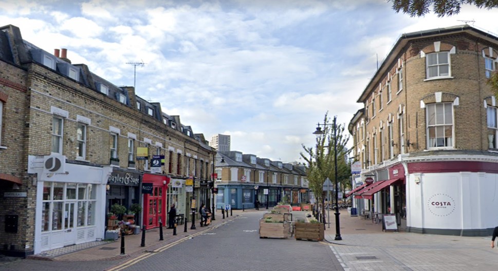
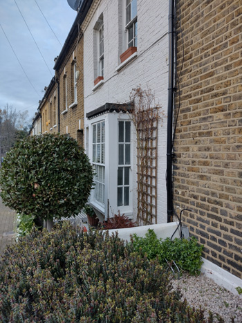
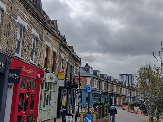
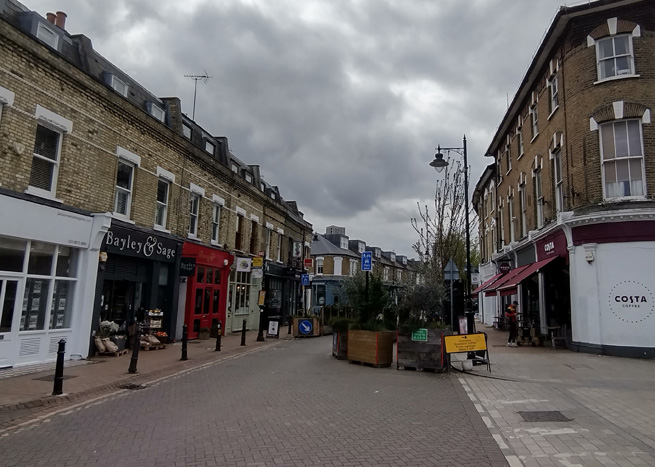
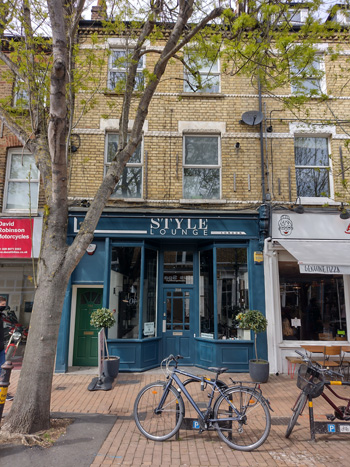
Old York Road is characterised as a short shopping parade, and despite some alteration, has a consistent appearance and scale throughout. Buildings are typically terraced groups of 3 storeys to the north and 2-3 storeys to the south, constructed of stock brick, with simple architectural embellishments of brick, terracotta, and stone. Terraces generally form a complete frontage between streets, which creates a sense of enclosure, and predominantly have a standard typology within these groups. There is regularity in the terraces with individual properties having 1-2 bays and end units addressing corners. These corner buildings are a key characteristic of the area, and generally have wider return elevations.
At ground floor, use is almost exclusively commercial, with some residential to the rear of plots at Edgel, Tonsley Hill, and Ebner Street. Occasionally ground floor shopfronts of adjacent units have been combined, but external elements have been retained to keep a legible degree of separation. The commercial use is key to the character as a local shopping parade.
Most timber windows have been retained and are typical sash with a single pane or two-over-two. The roofs are slate or tile, and interventions have generally been limited to mansard style roof extensions with dormer windows to front elevations, changes which have predominantly been sympathetic to host buildings.
Wandsworth Town Station and the railway bridge are included in the Conservation Area and form an important marker or gateway to the Conservation Area, and to a lesser degree, as a transitionary space between the two character areas. The Station has many historic components, which survive including the hexagonal brick piers which frame the bridge at either side with riveted iron in between; an extensive update was carried out in 2011, which saw a larger, modern entrance introduced.
The Station leads to a small forecourt which is the primary open/civic space in the Conservation Area, which contributes to the sense of arrival. The area has two commercial kiosks, street trees, seating, and wayfinding furniture.
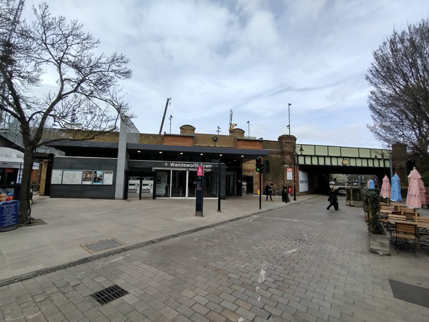
Fig. 60: Train Station Entrance and Public Space
Spatial Analysis
The linear character area has an overall intimate feel which is the result of its scale and use. The consistent building heights and frontages created by the terrace groups gives a sense of enclosure to the area, and its use as a shopping parade adds liveliness. This is enhanced by active shop frontages, which often include external displays of goods, as well as numerous terraces to restaurants and cafes, which spill onto pavements. With continued public realm improvements planned, this experience should be heightened as pedestrianisation is encouraged. The area is particularly busy in the morning and evening given the proximity and access to the Station. A lack of through traffic makes the area inviting to foot traffic and cyclists, and is an important characteristic of the experience of the area.
Views
The gentle curve of the street means the terminating point of views shift as one travels along but are primarily defined by Wandsworth Town Station to the east and toward the Ram Brewery westward. Currently, some tall building development breaks above the consistent building line of the road, notably Sudbury House and Wandsworth Exchange, which gives the impression of a different character beyond – the denser, urban development of the High Street.
Development proposals coming forward for former industrial and commercial sites in the immediate surround will see further tall building development introduced to the setting of the Conservation Area, which will result in a substantial change to its setting. Tall buildings emerging to the north and east of Wandsworth Station in particular will heighten the importance of its small scale, domestic character, and its contrast in appearance as a historic focal point. These taller buildings will be readily visible in views from within the Conservation Area, with the station providing a clear boundary between the Conservation Area and contemporary development.
Figs. 61 & 62: Taller building development in Wandsworth Town visible projecting above the consistent terraces
Townscape details
Paving
The character area is paved in two distinct areas given the redevelopment of the Station and its entrance in 2011. The forecourt itself and pavement to the south was finished in stone pavers and the portion of the road between the railway bridge and Ferrier Street, as well as the entrance to Ferrier Street, were laid with grey bricks in a running bond. New stone kerbs flush with the road have been inserted. The remainder of Old York Road is paved in purple bricks in a houndstooth bond, with red brick running bond pavements. The kerbs are also brick in a mix of red and purple.
The wider pavement to the north side of the road is also an important feature of the area, allowing restaurants to have sizeable outdoor terraces, which combined with A-boards and active shop frontages, makes for a lively street scene, and heightens a sense of human scale.
Old York Road is also part of a Cycle Super Highway, and as such, appropriate markings have been applied to road surfaces to denote this.
Figs. 63 & 64: Paving types to the Character Area
Shopfronts
Shopfronts are consistent, with some historic surviving or sympathetic modern insertions, which follow traditional design principles. Most shops are occupied by independent businesses so there has been limited pressure for standardised corporate branding, which has allowed for traditional signage and displays, and where chains have occupied, their branding has been reduced to match this character. There are only a few examples of shops merging to create larger units, but where this has been carried out, shopfront elements remain distinct to the separate host building.
Stall risers, fascia boards, and transoms are largely uniform in appearance along the street, and where some modern intervention has occurred, there are often historic elements remaining such as corbels, giving glimpses to the more traditional shopfronts which have been replaced. Combined, these elements add to a pleasing experience of the historic shopping parade. Other elements which contribute to this sense of place include a uniform materials pallet for the road, pavements, and station forecourt, subdued lighting, street furniture, and street trees.
This gives the street a pleasant appearance and presents a consistency which should be retained. Signage is largely limited to letters on the fascia, which may be illuminated from behind or above, and simple hanging signs, and new signage should follow these simple approaches.
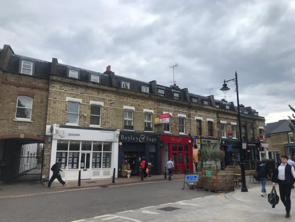
Fig. 65: Good group of traditional shopfronts create active frontages which contribute to a vibrant streetscene
Figs. 66-68: Shopfronts with traditional design principles and historic elements compared to an overly glazed contemporary approach (Fig. 69)
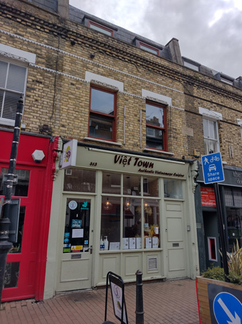
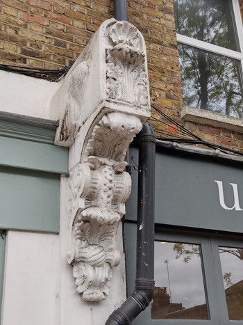
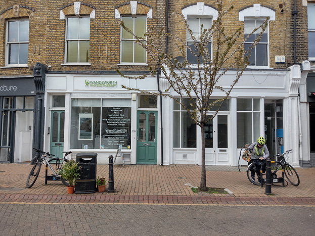
Fig. 70: Surviving pilasters and corbels are some of the surviving elements of these modified historic shopfronts
Open Space and Trees
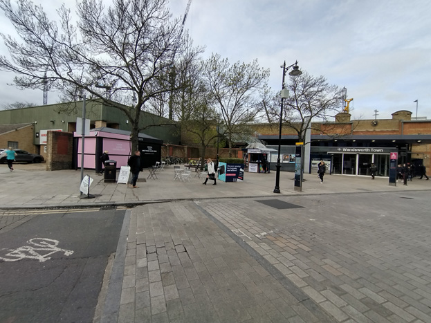
Fig. 71: The Station forecourt offers the only public/open space within the Conservation Area
The Conservation Area lacks open space except for the ‘square’ in front of Wandsworth Town Train Station, which both allows passengers to disperse to the surrounding area and forms an entrance to the Conservation Area. The ‘square’ is simply designed with street trees, raised beds, and some seating. Within the square are two small kiosks and street furniture such as wayfinding boards. The street trees and front gardens contribute to the character of the streets and provide a leafiness to the area, connecting the more landscaped residential area with the commercial road, and therefore contributes to their character.
Trees are regularly planted along the north side of Old York Road, and these semi-mature plantings enhance the suburban character of the area – offering visual relief to the otherwise solidly built streetscape, as well as providing shelter and shade to the pavement, where many restaurant terraces are set up in warmer months. With the planned public realm improvements of the road, this function will become even more prominent and their contribution to a suburban feel even more apparent.
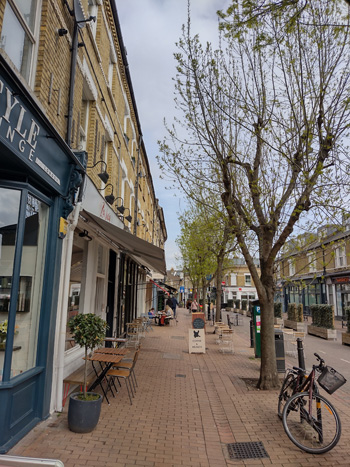
Fig. 72: Regular tree planting (Raywood Ash) heightens the pedestrian scale and appearance of Old York Road
Street Furniture
Bollards
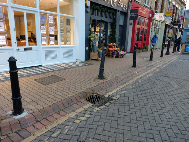
Fig. 73: Bollards to Old York Road
Bollards are spaced regularly along the length of the character area and when considered with the brick paving, demarcate the importance of pedestrian space and access to the character and use of the area. With additional public realm improvements introduced in future, the functional purpose of the bollards may be lost, but they remain reflective of the original layout, add visual interest, and provide a safety barrier to the paving in front of commercial premises, and should remain in place.
Street Signage and Bus Stops
Existing signage is largely restricted to existing lampposts which reduces the need for additional street furniture and avoids cluttering the streetscape. Any additional signage required should be displayed on sympathetic black metal posts if they cannot be fixed to existing.
Although bus stops will likely be renewed or relocated with the public area improvements of the road, stop information can be displayed on existing posts or, where necessary, new posts of a consistent style.
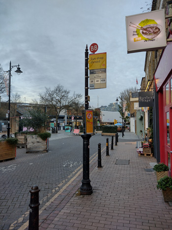
Fig. 74: A bus stop marker
Lamp Posts
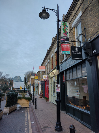
Fig. 75: Lampposts are in a traditional style and painted black, with modern, energy efficient LED lighting
Cycle Parking
There is a good amount of cycle parking along Old York Road in the form of simple black Sheffield stands set into the pavement. Additional cycle parking should match or be of a similar style and would encourage a lively pedestrian street.
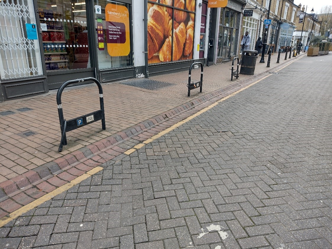
Fig. 76
Wayfinding
Current wayfinding materials follow the Legible London design standards which are common around London. These simple rectangular pillars display pedestrian and cycle information on large graphic maps. There is also a single traditional style marker giving walking distances to local points of interest.
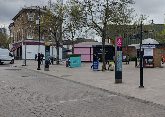
Fig. 77
Digital Advertisements/Communication
There is a single BT Street Hub which has two large digital displays on either side and offers digital communication options, such as calls, Wi-Fi, and phone charging, to the public. While the footprint of the display is smaller than a traditional payphone, the siting and nature of a digital display is disparate to the historic environment and a distracting feature, interrupting both a heavily pedestrianised area and views through. These types of equipment would be better placed with other street furniture within the public realm of the station forecourt.
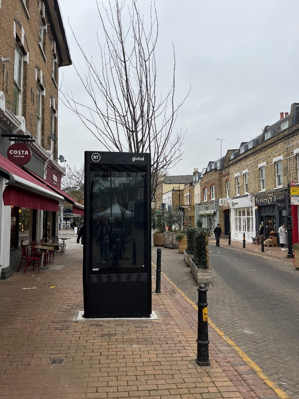
Fig. 78: Digital advertisement display
Detracting Features:
- Unsympathetic window forms and materials
- Satellite dishes fixed to front elevations
- Lower quality residential development to rear of corner buildings / along side streets
- Contemporary shopfront designs and Signage
- Digital Advertisements
Part Three: Management Strategy
Summary
The Appraisal has assessed the quality and the condition of the Old York Road Conservation Area. Several site visits were undertaken between May 2021 and April 2022, when the area was observed and photographed.
This Appraisal has summarised the strengths and weaknesses of each character area, and this management plan will set out a strategy to consolidate and enhance these strengths and prevent the further erosion of the area’s special historic and architectural character.
The overall conclusion of the Appraisal is that, despite piecemeal erosion, all areas of the Conservation Area are worthy of inclusion. It is hoped that this clearer, more extensively illustrated Appraisal will assist the Development Management process in making more informed planning decisions in respect of the Area’s character as well as providing clear guidance to residents.
Under section 71 of the Planning (Listed Buildings and Conservation Areas) Act 1990 local planning authorities have a statutory duty to draw up and publish proposals for the preservation and enhancement of conservation areas in their districts from time to time. Regularly reviewed appraisals, or shorter condition surveys, identifying threats and opportunities can be developed into a management plan that is specific to the area’s needs.
Design Guidance
Historic England recommend that the Appraisal is also a source of guidance for applicants seeking to make changes that require planning permission, helping to make successful applications.
The design guidance below sets out how good quality design helps to both preserve and enhance this Conservation Area.
Dwellings within the Conservation Area which are blocks of flats do not benefit from Permitted Development Rights. These include the group on Podmore Road, Ebner, Edgel, and Morie Streets, as well as most of the housing to Old York Road. These properties always require planning permission to carry out alterations and extensions.
Windows
Windows make a substantial contribution to the appearance of an individual building and can enhance or interrupt the unity of a terrace, so it is important that a single pattern of glazing bars should be retained within any uniform composition. Generally, windows follow standard patterns/styles. In Georgian and early-mid Victorian terraces, each half of the sash was usually wider than it was high, but its division into six or more panes emphasised the window’s vertical proportions. Later Victorian and Edwardian buildings often employed a simpler pattern, with the top and bottom sash either having one large pane, or a single central glazing bar.
Many original timber sliding sash windows survive within parts of the Conservation Area and these make an important contribution to the special character and appearance. However, some have been lost and many replacements are of a different style and materiality which is unsympathetic to the historic appearance of the building and conservation area, disrupting the harmony and rhythm of the legible groups, and creating inconsistences within the otherwise congruous terrace typologies.
The quality of these replacements also varies, which dilutes the consistent appearance of the building groups, with some mimicking historic style while others are inappropriate uPVC and casement windows. Where timber sashes have been replaced, these are often of poor quality, with thicker frames and higher reflectiveness, varied horn details, a variety of glazing bar formats, and there is a general lack of consistency to the approach to fenestration. Other inappropriate interventions include the widening of windows and introduction of large bow and bay windows, which creates visual disparity to the otherwise consistent scale and appearance.
It is encouraged that residents, in the first instance, retain and repair existing original timber sash windows. If replacement is required, all aspects of the window should be considered including opening type, glazing bar pattern, horns to sashes, and depth. Windows should be timber sash and are generally single panes with no glazing bars or a simple two-over-two. Timber frames are not only the most appropriate option, but a natural material which helps reduce the use of plastics, often found in other windows. Timber windows also have the benefit of being more cost effective, being much more durable and repairable than alternatives, and there are options to maintain their appearance while introducing energy saving and noise reducing features.
Single glazing is perhaps the most common window type. As such, simple like-for-like replacements would likely cause the least harmful impact on the existing appearance of a building and therefore the character and appearance of the area. Like-for-like replacements also benefit from being able to be carried out without the need for planning permission. Existing windows can often be improved through secondary glazing, where an additional glass layer is installed behind an existing window. Secondary glazing is an unobtrusive option to increase efficiency, reduce noise, and avoid intervention to existing fabric, often performing as well, and lasting longer than double glazing. This approach also often benefits from not needing planning permission.
Where appropriate and where there is justification for full replacement, slimline double and triple glazing with timber frames helps maintain a consistent appearance, while offering similar benefits to secondary glazing. Where double/triple glazing is accepted, black spacing bars and seals should be avoided – these should instead be white to blend with the frame. Trickle vents should be avoided or well concealed within the frame to maintain consistency with historic appearance.
Doors
Like windows, it is encouraged that residents, in the first instance, retain and repair any existing original timber doors. This is best for the environment, for the character and appearance of the area, and is often a more inexpensive solution to complete replacement. Simple modifications can often be carried out internally which improves the weatherproofing of the door without impacting its external appearance.
If a replacement is required, then it should match the original door for the host building’s typology. Within the residential area, these are relatively simple timber four panel doors with a door knocker to the upper centre to the Victorian terraces, and six panel doors to the Georgian group. Examples of good quality doors can be found in this Appraisal.
Roof Extensions
Residential extensions are suitable only to the rear, and both mansard and outrigger extensions have been executed successfully – however, many have made unsympathetic alterations, the cumulative effect of which is causing harm to the Conservation Area more broadly.
Where rear mansard roof extensions have been introduced, the roof ridge is often raised to accommodate an extension of a larger than appropriate scale. This creates an imbalance in the terrace pairs and an inconsistency to the slowly stepping form of the terraces as a whole, which is particularly evident in views sloping down toward Podmore Road and the railway. Any intervention to the rear roof should not project above the existing roof ridge to maintain the scale and appearance of the terrace, avoiding interrupting the characteristic stepping pattern.
Outrigger extensions are also increasingly common, and while largely consistent, many are of a different form, finish, position, and scale, which creates an imbalance to rear elevations, and again, a cumulative effect impacts views toward the rear of terrace groups. Care should be taken to sensitively introduce new aspects of an appropriate scale and positioning, which are legibly subservient to their host buildings. Outrigger extensions should be limited to half the depth of existing rear aspects and squaring off these extant outriggers should be avoided – instead, extensions should have angled walls to illustrate original building form and highlight subservience of the introduced building form. Subservience can also be emphasised by setting back extensions from the eaves and using 70° sloped elevations.
Other pressures to roof extensions include the finishes, with uPVC windows, artificial slate, and projecting/irregularly placed roof lights increasingly common, features, which will be managed to maintain and restore consistency.
Boundaries
Boundary treatments make a positive contribution to the streetscape and enhance the character and appearance of the conservation area. In the first instance, they should be retained and repaired where possible. Though extant treatments remain inconsistent, sympathetic form, material, and scale can be achieved for replacement boundaries by replicating common examples evident within the same terrace groups. These may be low brick walls or a combination of brick and rail, finished in a manner to match the host dwelling.
Gardens
Front gardens make a positive contribution and help illustrate the characteristic shift in design detailing evident in the residential area. Planting can soften the appearance of the continuous frontage and heighten this suburban feel. Full hard landscaping creates uninviting frontages and should be avoided. Glimpsed views to rear gardens and mature planting helps break up rear elevations and contributes to the overall suburban character.
Basements & Lightwells
Given the shallow front gardens characteristic of the Conservation Areas, lightwells located in front gardens are not appropriate, and would not comply with best practice outlined in the Housing SPD (2016) as well as DMPD Policies DMH5 and DMH7. Instead, rear lightwells would be the most appropriate provided they meet relevant planning policies. Existing lightwells inserted before designation as a Conservation Area should not be paired with full hard landscaping, but rather mitigated with soft landscaping elements, such as low maintenance shrubbery.
Basements are likely only appropriate where there is an existing cellar space and must follow best practice as outlined in the Housing SPD (2016). Given the limited capacity for lightwells within the Area, the insertion of basements may not be practical.
Painting and External Finishes
The painting of brick façades is uncommon and is discouraged and will require planning permission in the Article 4 area. Painting does not fall under permitted development for flats. Where painting has already occurred, paint should only be refreshed and in an appropriate colour selected to maintain the overall neutral palette of the conservation area.
External finishes, such as render, are not a common feature to the Conservation Area as a whole, and the approach to their treatment is similar to paint – where existing finishes can be repaired and restored, and new finishes not normally approved. The predominant character of the area is derived from the consistent use of brick with some details and dressings in white and red. Where full or part smooth rendering has been carried out, it has harmed the architectural coherence of the terraced groups and creates a visual disruption. Planning permission will be required for external finishes where the Article 4 Direction comes into effect and will not normally be approved at the front of properties and flanks on to streets.
Shopfronts and Signage
Traditional shopfronts are a vital component of the character and appearance of the Conservation Area and existing historic shopfronts should be maintained and repaired in the first instance. Where traditional forms have been replicated or contemporary shopfronts inserted, and need to be altered or replaced, these should follow traditional designs and adhere to Policy DMTS 9. Although dated, the Adopted ‘Shopfronts’ Supplementary Planning Guidance (1988) still outlines best practice principles to consider.
Signage should replicate traditional styles with painted or applied letters to the fascia and simple hanging signs. Modern signage, including corporate branding, internally illuminated projecting box signs, and box fascia, are discouraged. At present, projecting/hanging bars are often of an acceptable style and size, but often bolted to a corbel or other historic elements. Instead, these should be sympathetically places and attached within the fascia or to the building face. Where hanging signs are employed, these should use a traditional bracket and be of a simple design, as outlined in the shopfront SPD.
Shopfront Security
Projecting shutter boxes have a negative impact on the appearance of shopfronts and are not acceptable in conservation areas, nor are solid or perforated shutters. Unless they are continuously back-lit, the perforation is only really apparent directly in front of the shopfront itself – from other angles and from further away they seem solid, and solid shutters create an unwelcoming, unattractive environment. By blocking the interior, they also prohibit passive surveillance and are more likely to be graffitied, which would cause further harm to the character and appearance of the Conservation Area.
Instead, there are other systems which would be more suitable, and these are outlined in both the Shopfronts SPG, and the unadopted Security for shops: Design Guidelines. For contemporary shopfronts, more passive security measures can be effective, such as laminated glass, which is not readily apparent and therefore mitigates detracting from the appearance of the shopfront. Lattice brick-bond grilles can be installed internally behind the windows, with the box inserted into the ceiling – this prevents an external projecting box and the internal box from being visible through the shop window. This would allow for an appropriate level of security, while minimising the visual impact of shutters on the external appearance of the shopfront, and therefore of the Conservation Area. It also allows for passive observation by keeping the inside of the shop visible.
Energy Efficiency
Introducing energy efficient measures can be desirable to reduce carbon emissions, fuel bills, and improve comfort levels. It is important that the appropriate course taken should be informed by the context of the building being improved, with each building having different opportunities and restrictions. Not all solutions will be appropriate across the conservation area, and the ‘Whole Building Approach’ advocated by Historic England encourages a case-by-case approach, which fundamentally considers the context, construction, and condition of a building to determine which solutions would be the most suitable and effective. More detailed advice can be found within the Guidance Note Energy Efficiency and Historic Buildings: How to Improve Energy Efficiency 2018
Solar Panels
Solar Panels and equivalent technology are most suitably placed on rear or side elevations where they are hidden from the public realm – principal elevations and roof slopes facing the public realm are less appropriate as they generally make the most substantial contribution to the character and appearance of the Conservation Area. New technologies, such as PV panels disguised as slates and sitting flush with roof materials, may be suitable in the appropriate context, and will be considered on a case-by-case basis.
Appendix 1: Locally Listed Buildings
The Council holds a list of buildings that are of special architectural or historical interest at a local level. The list is a record of some of the historic buildings that are of particular interest, not just to this Conservation Area, but to the borough. These are different from buildings that are statutory listed for which consent is required for alteration. There are no additional planning controls over locally listed buildings other than those that already apply to the building; however, this designation is a material consideration under paragraph 203 of the NPPF (July 2021), which concerns non-designated heritage assets.
The following buildings in this Conservation Area are locally listed:
The Alma Public House - 499 Old York Rd
Imposing Victorian corner pub opposite Wandsworth Town Station. Named after battle in Crimea. The existing building is a 3 storey Victorian Pub with modern accommodation to south.
Ground floor has vivid green tiling of about 1900 which surrounds all elevations with a tiled fascia and stone cornice. To Old York Road, secondary entrance to the west with three paned casement windows to east with three smaller top lights. The first and second storeys are yellow brick and have three windows each, with six over six and three over three sashes respectively, with stone window surrounds. Above is a dentilled stone cornice with parapet sign.
The corner elevation entrance has glazed pair of doors with timber framing and transom above. At first storey there is four panel curved window, part fixed, part casement, with two top lights, in stone surround with stone banding above and flanked by two brick pilasters. This storey has a dentilled stone cornice and is topped with an octagonal turret comprised of timber framed windows and a domed roof.
The east elevation is four bays wide, at ground floor there regularly spaced openings of timber framed glazed doors and casement windows. The first storey has pairs of two pane casement windows with single top light in stone surrounds to each bay, separated by a brick pilaster and with stone banding above. Stone balustrade at roof level. To the south, a small traditional mansard with two dormers and decorative iron rail above. Set back brick third storey with hipped roof.
To the rear of the historic pub is a modern extension of 2-3 storeys with a yellow brick boundary wall with red coping. The stepped forward north element is largely glazed with timber mullions with green tile plinth with flat roof. The remainder of the development is three set back yellow brick blocks unified by modern opaque glazed elements. Aluminium framed vertical windows are regularly spaced and there is a stone fascia to parapet roof. Above to the north is a third storey flat roofed glazed extension with opaque glazed detailing matching below, and solar panels to the south.
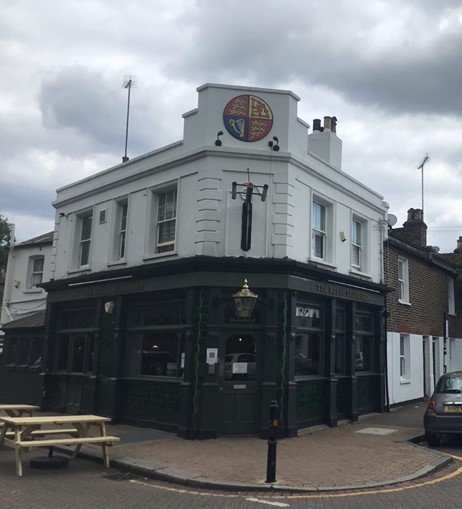
The Royal Standard Public House - 1 Ballantine Street
Two storey corner pub with part single part two storey side/rear element. Primary elevations have tiled green stall riser and timber pilasters, window surrounds, and stained-glass top lights. Upper storey is rendered with quoins, west elevation has two sash windows with simple sill, corner has traditional hanging sign, and north has two sash windows flanking a narrower central window. Parapet concealing hipped roof with the corner elevation having a projecting element. Rear elements have hipped roof to ground floor and pitched to first, slate tiles. Rendered boundary wall to Podmore Road with stone capping.
79-89 Alma Road
Short Georgian terrace of six houses dating from the early to mid-19th Century, representing some of the earliest residential development in the area. Two storeys with a parapet, which originally would have had a London Roof behind, but have since been replaced with mansard roof extensions. The dwellings are a single bay with London brick and stone plinth, quoins, cornice, and window surrounds, and have entablatures around the front doorways which are grouped in twos. Although the roofs have been modified, they remain relatively consistent in their appearance as tiled mansards with a single central dormer.
Street Bollards - Old York Road
Simple black cast iron bollards are regular spaced along Old York Road and form an important townscape element, visually separating pavement from the road and enhancing the linear character of the street.
Appendix 2: References
Primary References
Photographs, unless otherwise indicated, taken by Stephen O’Fegan - Conservation Officer
Wandsworth Heritage Service
Secondary References
Baxter, Arthur (1900) ‘Arthur Baxter's Notebook: Police District 35 [Kennington (2nd) and Brixton], District 37 [Battersea West], District 38 [Clapham], District 39 [Wandsworth and Putney], District 40 [Streatham, Norwood and Dulwich]’
Booth, Charles (1902) ‘Life and Labour of the People of London’ Published by Macmillon and CO. York. https://booth.lse.ac.uk/
Gerhold, Dorian (1998) ‘Wandsworth Through Time’ Published by Historical Publications, London
Historic England (2016) ‘Conservation Area Designation, Appraisal and Management: Historic England Advice Note 1’ Published by Historic England, London.
Historic England (2017) ‘Understanding Place - Historic Area Assessments’ Published by Historic England, London.
Kelly’s Directory 1890 ‘London’. Published by Kelly and CO. London
Walford, Edward. "Wandsworth." Old and New London: Volume 6. London: Cassell, Petter & Galpin, 1878. 479-489. British History Online. Web. http://www.british-history.ac.uk/old-new-london/vol6/pp479-489.